Looking for a new way to explore our Outer Banks national parks this summer? Check out this handy guide to the trails at Cape Hatteras National Seashore, Fort Raleigh National Historic Site, and Wright Brothers National Memorial! From shorter strolls to longer loops, there’s something for everyone!
Cape Hatteras National Seashore Trails
Bodie Island
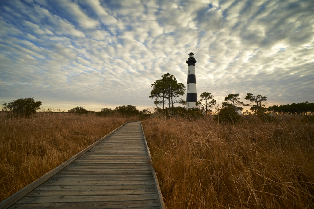
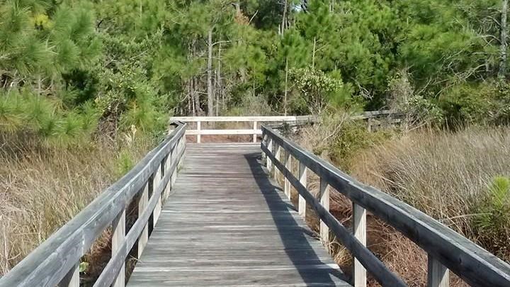
Bodie Island Boardwalk Trail: An eighth-of-a-mile-long, accessible boardwalk (one way) leads through a marsh to a freshwater pond. Along the way, and at the observation deck at the end of the boardwalk, you can smell the freshness of the marsh and experience the wildlife around you. Birds migrating along the Atlantic Flyway make use of the freshwater ponds, offering a chance to spot different birds throughout the year. The pond and surrounding wetlands are also home to a diverse range of species, including blue crabs and snapping turtles! The observation deck at the end of the trail has three benches and spectacular views of the Bodie Island Lighthouse and surrounding ecosystems. Parking is available at the start of the trail in the parking lot north of the Bodie Island Visitor Center. At the start of the boardwalk are restrooms, a drinking fountain with a pet fountain and water bottle filling station, a trash and recycling station, and a bike rack.

Bodie Island Baseline Trail: Follow this path through the woods from the Whalebone Junction Visitor Center to discover an 1848 survey marker from one of the first coastal surveys completed by the grandson of Benjamin Franklin! Length: 0.75 miles out and back.
Off-Island Trail: This quarter-mile long trail begins at the Bodie Island Lighthouse parking area and follows along a gravel road offering an opportunity to explore the marsh ecosystem from the ground and visit the Roanoke Sound, part of the Pamlico-Albemarle Sound System. The Pamlico-Albemarle Sound System is a network of sounds that make up the second largest estuarine ecosystems in the United States of America. Length: 0.5 miles out and back.
Hatteras Island
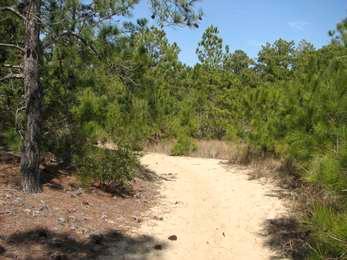
Salvo Woods Trail: This trail follows looped paths through the maritime forest and offers glimpses of what it is like for plants and animals living on the edge of the continent. Length: 0.4 miles round trip or 0.75 miles round trip.
Buxton Woods Trail: In Buxton Woods, a Hatteras Island maritime forest, look past the oceanfront sand dunes and discover the towering pine trees, thick sandy ridges, small ponds and marshes, and the menagerie of local island wildlife. A 1.75-mile-long, self-guided loop trail leads from the picnic area through Buxton Woods and back. Along this relatively level path, you can see the diverse forest ecosystem up-close, practice your skill at identifying trees, listen to the call of birds, and traverse some of the highest points on Hatteras Island.

Cape Hatteras Lighthouse Multiuse Pathway: This brand new, paved, multiuse pathway connects NC 12 in the village of Buxton with Old Lighthouse Beach and the Cape Hatteras Light Station by following Lighthouse Road. Length: 1.25 miles one way; 2.5 miles out and back. *Outer Banks Forever supported this pathway!
Open Ponds Trail: This trail, part of the Mountains to Sea Trail, traverses dunes, shrub thickets, and maritime forests of Hatteras Island as it winds its way between the British Cemetery near the Buxton Woods Picnic Area and Trailhead and the Frisco Campground. Length: 4.5 miles one way; 9 miles out and back. Open Ponds Eastern Trailhead: A small parking area at the trailhead accommodates a limited number of vehicles. Open Ponds Western Trailhead: No parking is available at this trailhead. The closest parking spaces are at the entrance to the Frisco Campground.
Boundary Trail: Branching off the Open Ponds Trail, this trail borders the Buxton Woods Preserve and provides hiking access to the preserve. Explore one of the largest remnants of coastal maritime forest along this trail. Length:1.25 miles one way; 2.5 miles out and back.

Loran Road Trail: The Loran Road Trail, as the name implies, was once a road leading to a LORAN (LOng-RAnge Navigation) tower. The US Coast Guard operated the tower from 1949 to 1981, providing additional navigation aid to ships equipped with the LORAN system. Now, the 1,400-foot asphalt roadway is an accessible trail that leads to a sandy path, which provides access to the beach. There is an accessible parking space at the start of the trail, and possible space for an additional two vehicles. Length: 0.25 miles one way; 0.5 miles out and back.
Buxton Woods Reserve: The Buxton Woods Reserve is a 1,007-acre part of the North Carolina Coastal Reserve on Hatteras Island, sharing much of its border with Cape Hatteras National Seashore, preserving the largest contiguous tract of Maritime Evergreen Forest on the Atlantic Coast. The Reserve may be accessed from the Open Ponds Trail or from various access points in Buxton.
Mountains to Sea Trail: The Mountains to Sea Trail is a long-distance trail that traverses North Carolina from Great Smoky Mountains National Park to Jockey’s Ridge State Park. The trail passes through diverse landscapes including national parks, national forests, wilderness areas, and state parks. On Cape Hatteras National Seashore, the trail enters the park via ferry on Ocracoke Island and travels along the beach to the northern boundary with the Town of Nags Head. Segment 18 is the Outer Banks portion of the trail and is 82 miles long.
Ocracoke Island
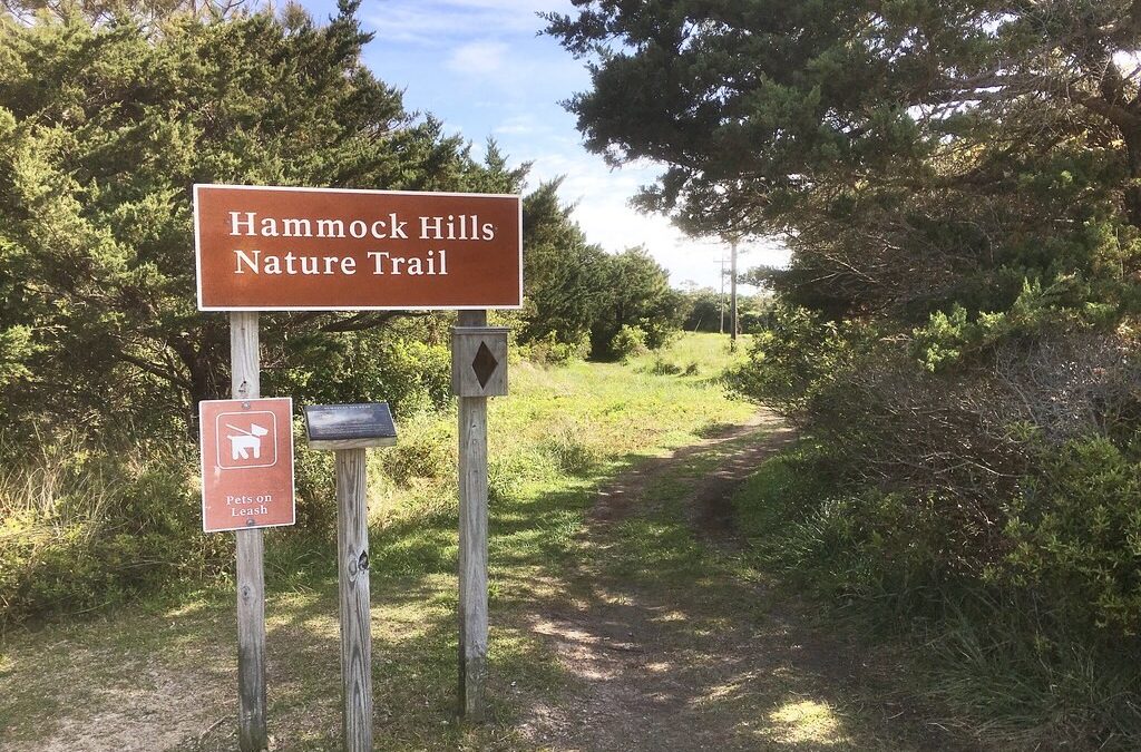
Ocracoke Multiuse Path: Connecting Ocracoke Village to Ocracoke Campground, this paved multiuse trail is open to bikes, strollers, walkers, and hikers. Paralleling Highway 12, this path also provides access to the Ocracoke Airport/Ramp 70, Ocracoke Beach, the Ocracoke Pony Pens, and the Hammock Hills Trail. Length: 3 miles one way; 6 miles out and back.
Hammock Hills Trail: The trail begins its journey to the marshy grass-lined edge of Pamlico Sound in a shrub thicket woodland. It crosses a boardwalk and splits into its loop just past a small, freshwater branch of Island Creek. Go right, and the trail passes an open dune-scape where you’ll notice low-growing prickly pear cacti. The path swings into a pine forest where distance from the ocean and an accumulating layer of soil invites less salt-tolerant species to take hold and mature. After more shrub thicket, a wooden viewing platform appears on the edge of the sound. Along the marsh, vegetation varies from the salt meadow hay found above the highest tide lines to black needle rush and saltmarsh cordgrass. A rich organic stew of minerals, saltwater, and decaying sea and plant life creates the perfect nursery for fish and crustaceans such as clams, crabs, and oysters. The trail swings back away from the marsh among thickets and then re-enters the pine forest. Length: 0.75-mile loop.
Springers Point Preserve Trail: Managed by the Coastal Land Trust and not on National Park Service property, this trail provides access to one of the state’s significant natural heritage areas where you can see a unique maritime forest with a unique variety of plants and colonial waterbirds. The trail also traverses the area where pirate Edward Teach, also known as Blackbeard, would frequent and eventually met his fate just offshore. Length: 0.8 miles.
Fort Raleigh National Historic Site Trails
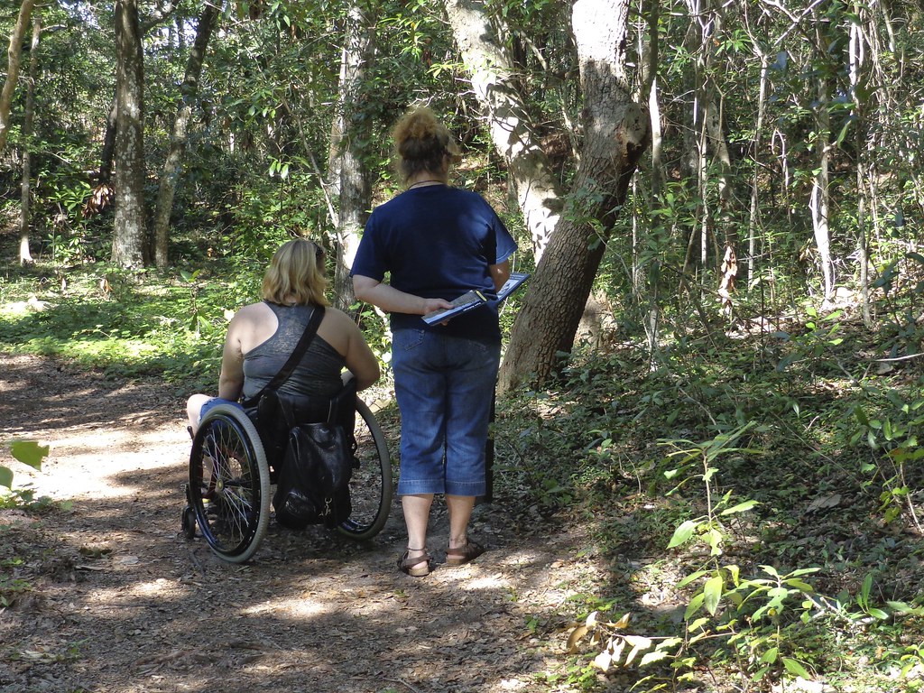
Thomas Hariot Nature Trail: The Thomas Hariot Trail is the shorter of the two Fort Raleigh trails. Starting near the Fort Raleigh Earthworks, the Hariot Trail weaves a 0.5-mile loop through the maritime forest of Roanoke Island. The sandy trail with access trails to the beach has sights across the Roanoke Sound to the barrier island communities of Nags Head, Kill Devil Hills, and Kitty Hawk. On clear days, the Wright Brothers Monument is visible on Big Kill Devil Hill across the sound. The trail has several wayside exhibits highlighting Algonquian and English history of Fort Raleigh. The loop trail returns to its starting point near Fort Raleigh Earthworks. Look out for signs of wildlife along the trail, as squirrels and birds abound in the maritime forest.
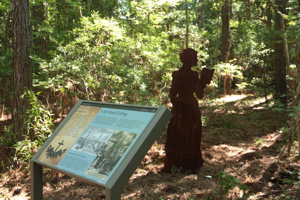
Freedom Trail: The Freedom Trail is the longer of the two Fort Raleigh trails, traversing the north side of the island from Fort Raleigh to Freedmen’s Point. The 1.25-mile one-way trail (2.5 miles out and back) starts in the parking lot for the Elizabethan Gardens crossing through dense forested areas of Roanoke Island. The trail ends at Freedmen’s Point near the Old Mann’s Harbor bridge, an area of the island that was part of the Freedmen’s Colony of Roanoke Island. The trail travels through loblolly pine forest with sections of dense undergrowth. Along the trail are 9 silhouettes and 8 waysides highlighting an individual story from the Freedmen’s Colony on Roanoke Island. A return journey can either be done on the same trail, or the Roanoke Island multi-use path can be walked back to the park. Be careful of bikers and cars when using the Roanoke Island Multi-Use Trail. The trailhead is across the parking lot from the Elizabethan Gardens and offers ample parking. *Outer Banks Forever supported this enhanced trail!
Roanoke Island Multiuse Trail: In addition to the two Fort Raleigh park trails, the Roanoke Island Multiuse Trail also follows the boundary of the park along Highway 64. Starting at Freedmen’s Point, the multiuse trail goes 7 miles along Highway 64 into downtown Manteo. This paved trail allows people to walk, run, bike, or horseback ride from the park into town. Be sure to watch for bike riders on the path and cars at the crossing of Weir Point Drive. Hikers and walkers can opt to use the Multiuse Trail and the Freedom Trail as a loop for a 2.5-mile roundtrip journey. Biking is not allowed on the Freedom Trail. Visitors can access this trail from Fort Raleigh National Historic Site by parking at the Lindsay Warren Visitor Center and walking down the entrance road to the park sign.
Wright Brothers National Memorial Trails
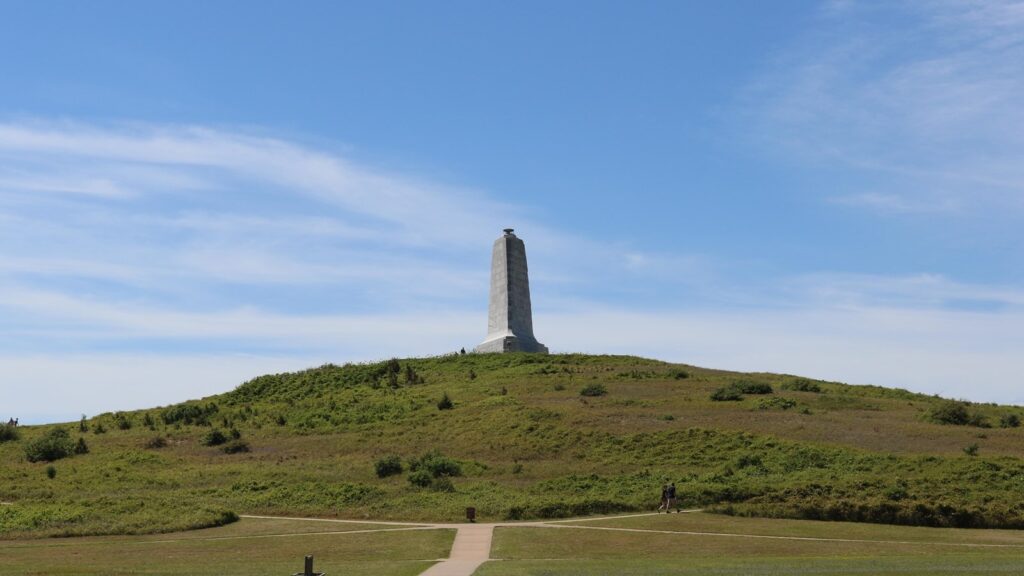
Big Kill Devil Hill Pathway: Big Kill Devil Hill can be accessed by walking a sidewalk connecting the Visitor Center to the hill, or by driving and parking at the base of the hill. At the top of the hill, two steps are required to reach the base of the monument, and if open, two steps to descend into the base of the monument. A flat, concrete path leads from the Visitor Center to the First Flight Boulder and the base of Kill Devil Hill. The path to the top of Kill Devil Hill is paved, but the grade becomes very steep toward the top of the hill, ranging between 14% and 24% slope. Some paths to the top are shorter, and others are less steep. Please talk to a park ranger to select a path that is best for you.
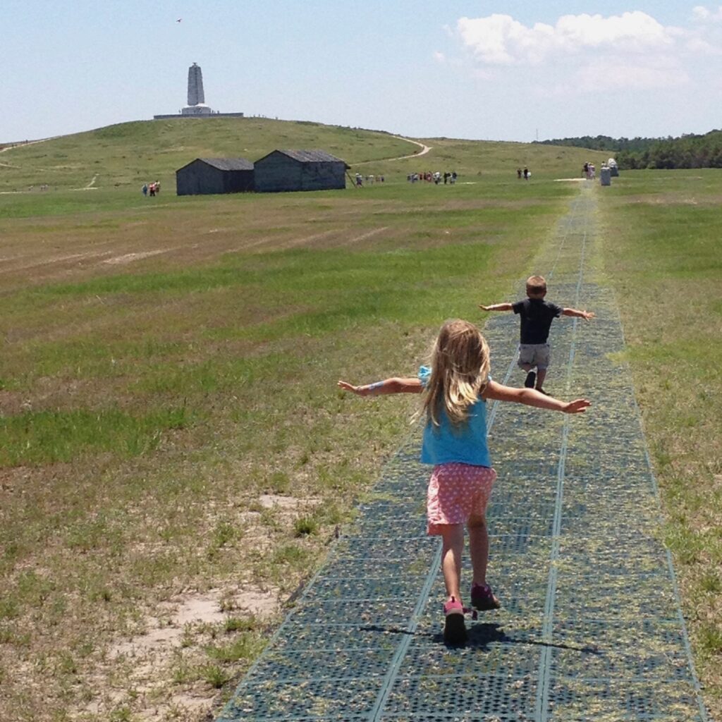
Flight Line and Camp Buildings Pathway: The reconstructed camp buildings and flight line are a short distance from the Visitor Center via a level, paved path. The flight line is not paved but is stabilized with rubber matting that may be suitable for certain mobility devices. A small step is required to enter the reconstructed hangar.
Sources Compiled:
I did not realize there were so many trails for walking! Excellent guide.
Thank you! Happy Trails 🙂